How to Geolocate Photos on a Map

Table of Contents
How to view GPS coordinates of a photo in Windows

- Browse to the photo in the File Explorer
- Right Click Photo > Properties
- Click on the Details tab
- Scroll down the details list until you see GPS. The location of the photo can be found in the Latitude and Longitude property.
In this example, the photo has the following coordinates:
- Latitude: 33 49 27.3699999999954
- Longitude: 151 11 45.270000000018662
Note: Latitude is the distance North or South of the equator line (shown in Degrees, Minutes and Seconds). Longitude is the distance East or West of Greenwich, England (shown in Degrees, Minutes and Seconds).
The problem with the above GPS coordinates is that the “GPS Latitude Ref” and “GPS Longitude Ref” values are missing. You need these to specify the correct orientation for each angle.
How to view GPS Latitude Ref and Longitude Ref information

GPS Latitude Ref: South
GPS Longitude Ref: East
What if the GPS coordinates are not there?
If you’ve followed the above steps but don’t see any GPS data in the photo file, it probably means that the data was not saved when the photo was captured or it was removed when it was shared with you. Unfortunately, there’s not much you can do to get it back (unless you have the original photo).
Some phones have settings that will disable GPS logging when using the default camera app. Also, most chat programs like WhatsApp and Telegram will clear any sensitive data like GPS location for privacy reasons. This can be a problem in construction if you have multiple people taking photos using different devices and then sharing them. We created SiteCam to solve this problem. SiteCam centralizes all your team’s project photos into one place and organizes them on a plan or a map.
How to view the location on Google Maps
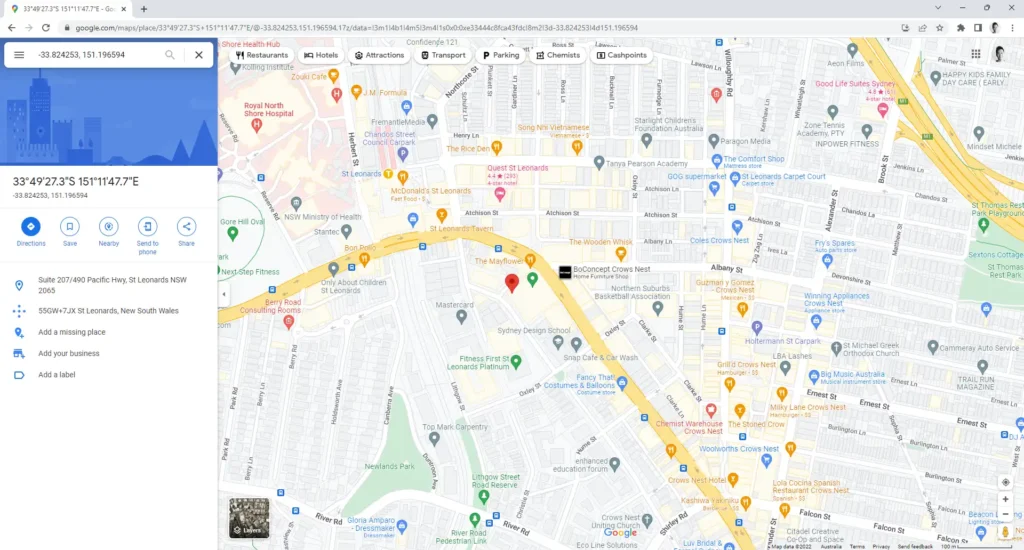
You can punch GPS coordinates directly into the Google Maps search bar to view the location on a map. However, you have to use one of the accepted formats:
- Decimal Degrees (DD): -33.824253, 151.196594
- Degrees, Minutes, and Seconds (DMS): 33° 49′ 27.3699999999954 S, 151° 11′ 45.270000000018662 E
- Degrees and Decimal Minutes (DMM): -33.82427, 151.1959
As you can see, because our Latitude location is “South”, we have to put a minus (-) before the latitude value (for DD and DMS formatting). If the Longitude location was “West” we would have to do the same.
With the DMS formatting, we put the GPS Latitude Ref and Longitude Ref locations after each value.
Tell me an easier way!
Using IrfanView:
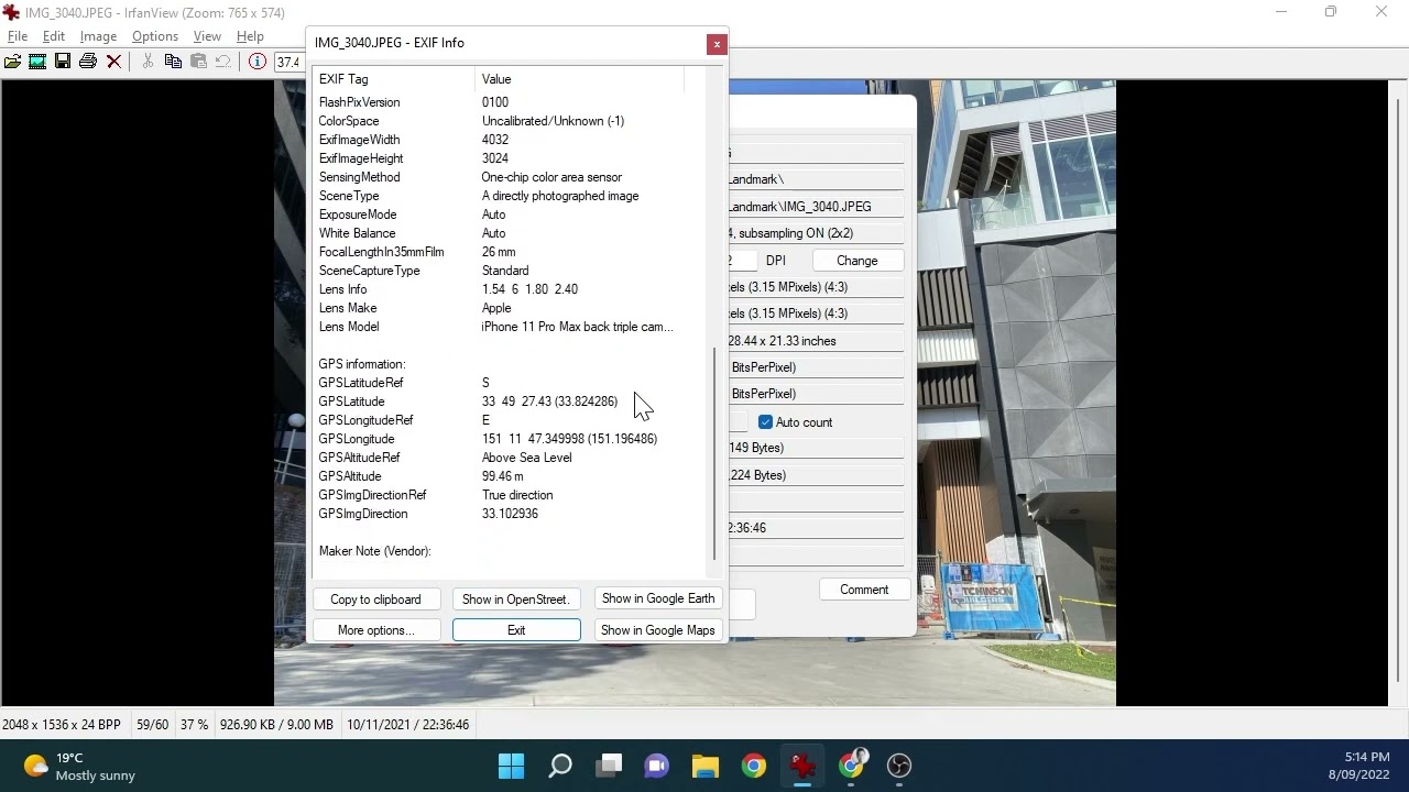
- Install and open the photo in IrfanView.
- Press the “I” key to open the Image Properties.
- Next, click on the “EXIF info” button.
- Finally click on the “Show in Google Maps” button.
- Your browser will open a new tab in Google Maps to the location where the photo was taken. There are other map options available too.
Using Windows Photos app:

- Open the photo in Photos app.
- Press “Alt + Enter” to display the file properties.
- There is a small map (BingMaps) in the file properties with the photo location. The drawback of this option is that the map is quite small and can’t be enlarged.
How accurate are the GPS coordinates?
There are many factors that will determine how accurate a GPS coordinate is on a photo such as the device, signal quality and even the weather. According to the gps.gov website, under open sky conditions, GPS-enabled smartphones are accurate to within a 4.9m radius. However this gets worse when you are near buildings, bridges and trees.
If you want to be able to log more accurate photo locations, use an app like SiteCam as it will let you refine the positions on a map.